
Which Mishawaka Neighbor Sources Explain a Block?
No official source offers a complete list of all Mishawaka neighbors around an address. The public record is split by task. GIS explains where parcels sit. Assessment records identify a recorded owner or billing record for one parcel. A deed documents a transfer, and a year-specific criss-cross directory may give a past occupant clue. The access and privacy limits matter as much as the displayed field.
| Source | Block evidence | Access and limit |
|---|---|---|
| MACOG parcel map | Polygons, labels, centerline, adjacent lots, and boundary layers | Free visual search; no automatic occupant list |
| City ArcGIS services | Parcel, centerline, service area, precinct, and other city-area layers | Public schema and queries; layer scope varies |
| Engage and LowTaxInfo | One parcel's owner, mailing, legal, assessment, and tax fields | Free; protected-person rules; not a street export |
| IndianaVoters | One person's status and polling details | No public block query; full file requests use county rules |
| Tapestry and Laredo | Recorded instruments tied to each parcel or legal description | Paid or subscription access; older records need counter work |
| Criss-cross directories | Historical address-to-occupant and telephone clues | Library or archive; dated and incomplete |
| Historic and HOA pages | Named area, public contact, rules, events, or preservation context | Not a member or household directory unless published |
The safest first output is a map with parcel IDs and public boundaries. Add owner names only when the research question requires them, and never equate a mailing address, tax owner, or organization with a current occupant.
Map Mishawaka Neighbors One Parcel at a Time
The documented MACOG method starts from one known address and then uses visual parcel identification. Its public guide does not promise a radius, buffer, or automatic neighbors button. That distinction prevents a user from expecting a bulk list the viewer was not built to supply.
- Open the MACOG Regional GIS Property Viewer, choose Getting Around, then Search St. Joseph County Parcels.
- Select Address, Owner Name, or Parcel ID, enter the value, search, and choose the matching attribute.
- Use Zoom to Feature and Highlight Parcel. Turn on parcel, address, and street-centerline layers.
- Click or identify polygons touching the lot and those directly across the street. Record each address and parcel ID before opening a separate card.
- Compare city, township, subdivision, school, precinct, zoning, flood, and taxing-neighborhood layers as needed.
- Use Print Map or Print Report and record the access date. Ownership and layer data can change.
The City of Mishawaka parcel services also support identify and query functions, while the county assessment map can lead to a PARCPRC property-card PDF. For a whole named road rather than the immediate block, use the Mishawaka by-street guide.
Mishawaka Neighbors Are Not the Same as Parcel Owners
Once each neighboring parcel ID is known, search it in Engage. Its result can include Summary, Sketch, Transfer History, Sales List, Valuation List, Taxes, Land Info, Improvement Info, Neighborhood Amenities, Documents, Street View, and Forms. A card may show owner, mailing address, situs data, and parcel facts. It cannot establish that every owner lives on the parcel or identify each person who does.
LowTaxInfo is the tax cross-check. It can show owner or billing fields, legal description, tax unit, property class, TIF, tax history, and amounts due. Data may lag the tax system by about 24 hours. A homestead-credit field can be a clue, but it does not turn a tax page into a household roll. Trusts, estates, businesses, and public bodies may appear as owner names, and a mailing address may be far from the situs.
Mishawaka Boundaries Change Who Counts as Neighbors
A nearby lot can share a street view yet fall in a different city, township, school district, precinct, subdivision, or taxing neighborhood. That is why the GIS map contributes more than owner labels. County guides name address centerline, city and town, annexation, subdivision, zoning, school, precinct, flood, hydrology, road, right-of-way, and aerial layers. Availability varies by viewer, so cite the specific layer used.
This geographic difference is not an error. Postal city names, municipal limits, and service territories answer different questions. City ArcGIS folders also list utility service areas and police beats, but a service-area layer does not identify a utility customer. Keep the polygon or district as the claim and do not infer a private account holder.
Mishawaka Neighbors and Published Community Contacts
The city Residents page describes traditional neighborhoods across Mishawaka and newer subdivisions seeking a hometown-neighborhood feel. It does not publish a central association list. Research found one specific association with a public site and several historic districts, but no complete citywide roster.
| Group or place | Public description | Best contact route |
|---|---|---|
| Rosewood Homeowners Association | Community near Fir Road and Climbing Rose Lane; site describes 115 single-family homes and 77 villas | Official Rosewood site for public management contact and notices |
| Normain Heights District | Historic geography along North Main north of McKinley | City historic-site and Historic Preservation Commission material |
| Riviera Place District | Historic geography centered on Riviera Drive | City historic-site records and public meeting packets |
| Cedar Street sites | Published sites at 315, 321, and 403 N Cedar | City preservation records |
| City boards and commissions | Plan, zoning, preservation, and redevelopment packets may name areas, petitioners, and addresses | City agenda and packet pages |
Rosewood's public pages provide announcements, guidelines, questions, and a management contact, but no member directory was observed. Historic districts are geographic and preservation records, not neighborhood associations. Churches, civic groups, and block-watch rosters may also be private; ask for archival or public meeting material instead of assuming a list exists.
A Mishawaka Neighbors Page Needs Community Context
A page capture from the City of Mishawaka residents resource provides a public starting point for neighborhood and community context.
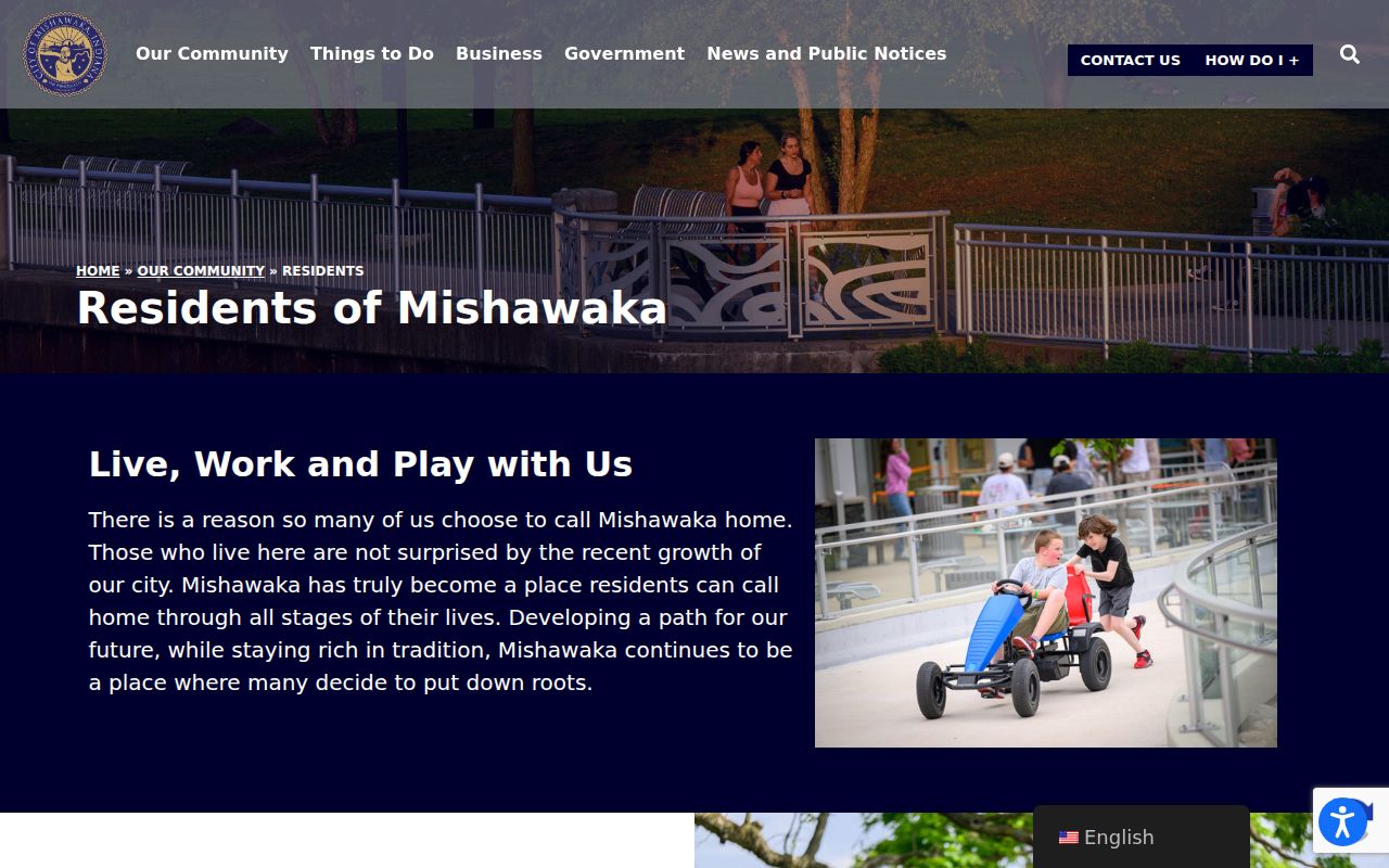
The city page supports the broad statement that traditional neighborhoods and newer subdivisions are part of Mishawaka's community pattern, but it should not be read as an owner or member directory.
For public civic activity, meeting packets can be more useful than a general page. Plan Commission, Board of Zoning Appeals, Historic Preservation Commission, and Redevelopment Commission records may identify a project, address, petitioner, and hearing date. State only the documented public role. A petitioner's appearance in a packet does not prove residence on the block.
Indiana Voter Rules Do Not List Mishawaka Neighbors by Block
IndianaVoters is a person-specific official workflow for registration status, polling place, ballot, and provisional-ballot status. It is not a command to show every registered voter on a block. St. Joseph County routes electronic voter-file requests through VRG-24, with use restrictions and redactions. County policy excludes fields such as Social Security number, date of birth, gender, telephone, email, voter ID, and registration date from its electronic release.
The Indiana Address Confidentiality Program can shield a participant's name, address, phone number, and identifying information. Engage also warns that covered-person names and addresses may be restricted under IC 36-1-8.5. A missing person is therefore not proof of absence, death, or ineligibility. Do not combine map and voter clues to uncover a protected address.
Official Mishawaka Rolls and Commercial Neighbor Tools Differ
Official sources are narrower, but they expose their keeper and record purpose. Commercial neighbor tools may merge public, licensed, and inferred data without showing when an address link changed. That makes a neat result look more certain than the underlying evidence.
Official record route
Searches one parcel, instrument, registration, map layer, or dated volume. It carries a custodian, field meaning, access date, and stated restriction. Certified copies come from the office that holds the record.
Commercial category
May combine address associations from several vintages. It can confuse owner, occupant, relative, mailing address, or former address. Verify every useful clue at the assessor, Recorder, election office, library, or archive.
For your Mishawaka neighbors, save the exact page or map result and write what the field proves. “Owner shown on the assessment card” is precise. “Lives here” is often not supported by that same source.
Privacy Sets the Edge of a Mishawaka Neighbor Lookup
A block map is not a household census. Non-owner occupants, utility customers, delivery accounts, protected voters, juveniles, and court-restricted people may be missing or confidential. Recorded documents can also display signatures, mailing details, and financial terms that are not needed for a simple parcel question. Request and retain only the fields needed.
A useful block story can stay focused on parcels, public boundaries, historic sites, land-use change, and dated civic records. Record parcel IDs before names, cite the public keeper, and avoid publishing a new list of private names and addresses. If an official record appears wrong, ask that custodian about correction. Indiana's private-data deletion rights do not erase deeds, tax records, or other government records held under separate laws.
Lawful use. Use a Mishawaka neighbor lookup for civic knowledge, community contact, or personal safety. Never use it to monitor, intimidate, harass, or expose another person.